Photo by Giles Laurent, CC BY-SA 4.0, via Wikimedia Commons
NamibiaTourism
From the orange dunes of Sossusvlei to the wrecks of the Skeleton Coast, Namibia is the most photogenic emptiness on the continent — the world's oldest desert, twice the size of Germany, and Etosha's wildlife under Earth's darkest night skies.
A country measured in horizons.
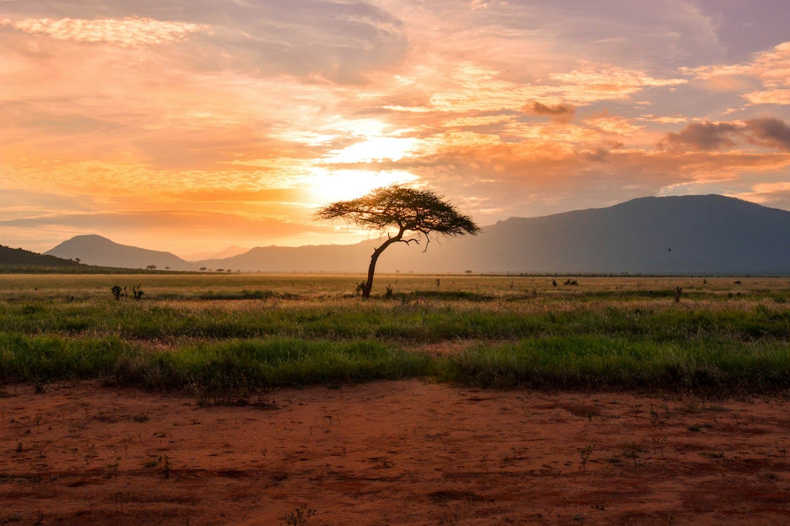
Namibia is more than twice the size of Germany with around three million inhabitants — among the lowest population densities on Earth — and almost all of it is desert. The Namib stretches the full length of the Atlantic coast and is widely held to be the world's oldest desert at fifty-five million years; its towering apricot dunes at Sossusvlei rise above 300 metres, among the tallest anywhere, and end in the white pan of Deadvlei, where centuries-old camelthorn trees stand petrified against the dune face. North of Sossusvlei the Skeleton Coast — named for the cattle bones and shipwrecks scattered along it — runs into the cold Benguela current that feeds Cape fur seal colonies and pushes fog inland past dawn. East across the central plateau lies the Kalahari, and in the far northeast the Zambezi Region narrows the country into a strip of water and savanna along four rivers — a different Namibia entirely.
This is one of Africa's youngest republics, independent only since 21 March 1990, and a country still working through a heavier-than-most colonial inheritance. Germany ran what was then South West Africa from 1884 to 1915 and conducted the 1904–1908 Herero and Nama genocide — widely recognised as the first genocide of the twentieth century; South Africa held the territory afterwards and extended apartheid into it. Independence stitched together a population of Ovambo, Kavango, Herero, Damara, Nama, Himba, San, and Afrikaner and German descendants under a single official language — English — chosen precisely to belong to no faction. The capital, Windhoek, retains German colonial bones; the coastal resort town of Swakopmund still feels like a small Bavarian seaside, transplanted; the Himba in the Kunene Region paint themselves daily with ochre and butterfat, a practice unbroken for centuries.
Namibia is a self-drive country. Tarred trunk roads link Windhoek to Sossusvlei (five hours), Etosha (four hours), Swakopmund (four hours), and the Fish River Canyon to the south; the gravel network beyond is well-graded and reliable for any decent 4×4. The dry season — May through October — is best for both wildlife at Etosha's waterholes and for hiking the multi-day Fish River trail (open May to September only). Then there's the visa shift: on 1 April 2025 Namibia ended its visa-free arrangement with most major Western nationalities (US, UK, EU, Canada, Australia) under reciprocity, and citizens of those countries now apply for an e-visa or visa-on-arrival before they board. Visitors from most Southern African states still enter visa-free for ninety days. The currency is the Namibian dollar, pegged one-to-one with the South African rand — and the rand circulates everywhere, a useful overlap for travellers arriving overland from South Africa or Botswana.
Practical info.
Climate
Best time: May–October (dry season; Etosha waterhole concentrations peak Jul–Oct; Fish River Canyon hike open May–Sep).
Visa & entry
Visa-free for ~22 nationalities (mostly Southern Africa); e-visa or visa-on-arrival for most others — US/UK/EU/Canada/Australia now require a visa (since 1 April 2025). Apply at eservices.mhaiss.gov.na. Reciprocity change: nationalities formerly visa-free (incl. US, UK, EU, Canada, Australia) must now obtain a visa from 1 April 2025; e-visa processes in ~3 business days. Standard tourist stay: 90 days. Passport validity ≥6 months with 3 blank pages.
Money
Namibian dollar (NAD). Mobile money is widely accepted; carry some cash for rural travel.
Safety & health
Anti-malarial cover for low-elevation regions; standard travel insurance recommended.
How is Namibia measured?
Tourism is the story; data is the context. Health, population, economy and climate indicators across Namibia — sourced from the World Bank, WHO and UNICEF.
See Namibia in numbers